WHEN THE GOOGLE MAP MAKER AFRICAN REGIONAL CONFERENCE WAS HELD IN LAGOS

Attending conferences in Lagos can be ecthic a times,  but it might be strategic for technology based conferences, in that most tech hubs and institutions are based in Lagos. Much reason why Lagos has the most populated points on Google Maps. While for me, August 24 – 25, 2012 was a good date, reason been it was just on the last day the Cloneshouse Nigeria‘s Monitoring & Evaluation Lagos training will be ending. After 5days of course facilitation, heading to another conference might be interesting.
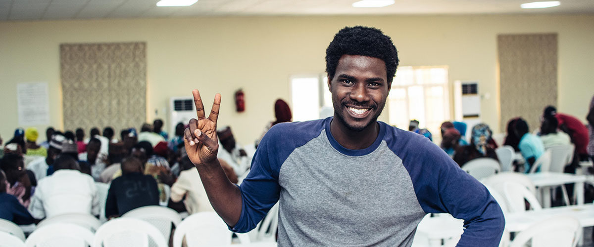
Cross section of participants at the Conference


The reception at the Victoria Crown Plaza Hotel on Victoria Island looks fascinating, and perhaps, it might be a 2days of rest. They have gotten some great facilities in their room. Entering, all I needed to do was to connect to the internet – it was exceptionally fast! Immediately I had to check where that network was from – MainOne Cable did the Job! A downloading speed at about 2mb/sec, none have seen like that in Nigeria. Maybe, a good reason why Evans, and the Google Map Maker team chose this location for the Africa Regional Conference.


Kicking off the keynote session was Jayanth Mysore, who presented how Google Maps have evolved over time –  From 22 countries (13million miles) in 2008 to about 187 countries (26million miles) in 2012. He emphasized on how all this data has been generated – (1) Ground Truth, which is an internal effort (Google Map Maker offices); (2) Contributions from Google Map users; (3) Google Place for Business where you add your business location and information of owner; (4) Data from Governments and Agencies where Google buys licenses from these organizations.
Jayanth Mysore – The Keynote Speaker at the conference


As the participants needed to know how the Map Maker community works and how they can organize Mapups (a Google sponsored event, in which a group or team come together to map places they know), Jesse Gibbons, the Community Manager was delighted to share this information. Perhaps, you will like join, you can check here. If you are a Google Map Maker user and would like to organize a MapUp , you can sign up here. Mapups are opportunity to share local knowledge and build communities while having fun! The Google Map Maker Community will be able to help with Food and Drinks, Equipment, Your Travel, printed materials – posters, banners, name tags, schwags – T-shirts, stickers, sunglasses and more.

Meeting other Mappers from other African countries was awesome. It was good to know that most were young citizen cartographers. Was pleased to see the trio – Leonard Ouma, Kevin, and Faith Gitau share stories of their mapping exercise around a university in Mombassa. Their main challenge was the access to broadband internet, a take away in most places in Africa. 

Max Adoko, Leonard, Kevin and Faith Gitau


Max Adoko, a Google Map reviewer from Uganda, told the story of how he used is precious time as a Systems Administrator at a Cyber Café to engage himself in Google Map Making. 
He shared some mapping stories from Uganda. Perhaps, the stories wouldn’t have left the four walls of the venue, if the Nigerian stories weren’t documented. Emmanuel Adepoju, a young Nigerian, Google Advocate and Ambassador that initiated the mapping of the University of Ibadan presented “Opening Nigeria to the World”. He shared stories of how Nigerian students have been mapping their various university campuses, and also extending the gesture to other local communities.

The Night seems longer than usual with a great outing at the popular bar on Lekki phase two. Chatting away with Muhammed, a Google Map reviewer from Gambia, and a man of great experience with geospatial technologies seems wonderful. He took all the great pictures during the conference, and he hopes to map every part of Africa.

Day 2 hopes to be interesting, dedicated to unconference sessions, where topics are suggested and chosen by participants. Nevertheless, the day was opened with the story by Gilbert Mucyo of how Kigali  in Rwanda was mapped. It was quite exciting to know that government institutions – The Ministry of Tourism and Wildlife Conservation of Rwanda were involved this time, with the aim of providing tourist with an easy access to the information they need to find their way along the tourist towns, thus making the exercise and its outcomes more sustainable. 

Gilbert (Rwanda), Funmilayo (Nigeria), Momodou (Gambia),
Faith(Kenya), Max (Uganda)


The unconference session included (1) Map making as a career, where participants agreed that Google Maps APIs could be used to create online yellow pages for communities; (2) Crisis Mapping and Data Collection, where crowdsource maps of the drought in Burkina Faso, the Lagos Traffic Map; and other crowdsourcing opportunities were shared, likewise how local communities could be engaged in Google Crisis Maps. The availability of SMS messaging for situational awareness during crisis was also envisaged; (3) Mobile Mapping, where most participants agreed that Google map maker should be made available as a mobile app, as most Africans accesses the web using their mobile phones; also the ability of the Track app, was mentioned, as a mobile mapping application; (4) Incentives for Mapping looked a great topic that might not end in a month in Africa, but it was agreed that badges and ratings could be included for Mappers, and souvenirs during Mapups can still serve as motivation; (5) Creating and Sustaining community beyond Mapups was also an interesting session. Adding Map maker to curriculum of schools were raised, also creating Map maker tech hubs in different cities to provide for equipments needed during Mapups, and also engaging Mapup participants in the uses of the maps they create.

Adepoju Abiodun, presenting Opening Nigeria to the World


Wow! In two days, citizen cartographers in Africa came together, to point out directions to the next level in digital mapping. As everyone hung on to their backpacks, the next mapup will definitely be on their mind, and how to engage local stakeholders. Way to go, Mappers!

STRUGGLING WITH THE FUTURE: MY FIRST ALMA MATA

When a crisis hits a vast institution it can seem reasonable to say that the task of handling the crisis falls mainly to the institution itself. It must regroup and survive, or else fail and collapse. But things change when there is evidence of criminal activity and of efforts to hide it. At that point it becomes urgent for everybody including good people inside the institution, to let daylight in and expose wrongdoing without hesitation to outside authorities.

All that might seem obvious, but for some of those at the helm of affairs of Nigeria’s primary education system for three decades now,  a call to order has yet to be made. Instead of fully accepting mismanagement of that sector, they keep shifting blames on one another.

As worrisome as it may be, that Nigeria still spend less than 9% of her annual budget on education – the mainstay of an economy, the share for primary education expenditure remains at 36%, which is much lower than that accross the continent- 48%. As at 2008, the total primary classrooms was 319,590, while total primary schools was 54,434 and total school teachers at 586,930. What does these figures tell us ? an average of 10 teachers per school, average of 70 primary schools in each local government area. The latter seem encouraging, however the distribution might be skewed, and in this part of the world, the large numbers of classrooms wouldn’t matter, it is the impact those four walls will have on the pupils that pass through it, this is worsened by the “mushroom” schools, also called private primary schools that  has taken over the country.

A Primary School with their teachers in Nigeria


According to the World Bank Data, Nigeria primary education witnesses a decline in % net enrollment of pupils, with 65% in 2007 and 58% in 2010. One might ask, why the decline? In neighbouring Benin, 89% enrolled in 2008 compared to 94% in 2010, Ghana also is encouraging its primary education sector growing from 72% in 2007 to 84% in 2011. Despite the incentives been given to lure children into school, the number seems to be decreasing. However, in as much as education isn’t free in Nigeria at this primary level, parents will still have an excuse of not sending their wards to school. It is good to know that some states like Imo, Ogun has started thinking in this direction- the northern governors are  should take  cue from this development.


Nevertheless, as 100% enrollment and free primary education might sound sexy, the quality of knowledge acquired from this institutions should be at par with the numbers. One might ask? Where does quality starts? The number of trained teachers in these primary schools in Nigeria still hangs at 66% in 2010, and when compared to other African countries such as Kenya with an average of 98% between 2009 and 2007; Rwanda with an average of 95% for years now; Togo, one of our neighbouring countries that in 2007 has 15% now has 77% of trained teachers in 2010. Between 2007 and 2011, Burundi and Tanzania has averaged 89% and 100% respectively of trained teachers in their primary schools. Can one give what he doesn’t have? It’s is quite obvious that priority should be given to the re-training of primary school teachers in Nigeria.

Nevertheless, as the NERDC (Nigerian Educational Research and Development Council) introduces the new curriculum ( an headache for the three tiers of schooling in Nigeria) for primary schooling in Nigeria, the institution that is responsible for training of teachers, should be strengthened with qualifiied trainers. When an institution needs cleansing, a times it should be revamped! To put it kindly, whoever has upheld those curriculum for the past decades must be out of touch with reality that is now catching up with the education ministry.

While universal primary education is important (Togo, Burundi, Madagascar, Rwanda, Sao Tome and Principe, and Tanzania have achieved or/are nearing the goal –MDG reports 2011), much value will be added through quality education. When  a country wants to become an economic power in the near future, it is not by “time travel”, it builds capacity of her human resources!

CAPE VERDE: THE AFRICAN HAVEN AT THE END OF THE WORLD

On the night of July 26, 2012, I left for Dakar (The Airport looks untidy with no wireless internet appearing anywhere on my gadgets), all that caught my eye was a black cat, strolling around the international transit lounge. As my flight to Praia, is on the next day, I had to bring out my rugged laptop and start reading, until my power cable made a pop sound! Telling me its morning already.

Flying to Cape Verde, there was no avoiding the sea. An archipelago of 9 islands, lying almost 450km of the western tip of Senegal. There was almost no slope or road or window from which the seas could not be seen. With a population of about 459,000, the sea took Capeverdeans away, flinging to France, Brazil and New England, while as many stayed changing to their Dry land. “While their exile broke hearts, it gave them money to send home” said Moses, an energetic taxi driver, speaking English vaguely, took me to Pestana Tropico Hotel. Certainly, he had so many to say about the Island, but the 700 Cape Verde Escudos (CVE) couldn’t take us longer than stopping in front of the hotel.

Taken from the Plateau, overlooking the Gamboa Beach
and the crowd at one of the city carnival

Just by the sea – Now that am “home” I can now look forward to the United Nations Space Based Information on Disaster and Emergency Response(UN-SPIDER) 5days Technical Advisory Mission to CapeVerde (meaning Green). While I was engrossed with my meal – Batata Frita (French Fries) and Atum grelhado (grilled fish), I peeped through my window, and just out there were a massive crowd, just by the Gamboa Beach. Since the weekend might be the only opportunity to catch a glimpse of what the summer is like, I decided to join the crowd, and perhaps – engage in some photography.

As the days of the week passed by – visiting organizations involved in Disaster and Emergency Response, my nights were occupied by responding to mails, and updating colleagues in Nigeria of task plans, while monitoring other important projects virtually. However on Wednesday, the UN-SPIDER team went on an excursion to Tarrafal, about 5hrs north of Praia. It was quite intriguing how the winding roads kept us in between the valleys, plateaus, and hills. Just on the road is a concentration camp built sometimes in 1936, turned museum since 1974. The town stands in a class of its own, with temperature at about 25°C, the beach was occupied by tourists from different part of the world, while the sea foods at the restaurant could leave your taste bud hungry for more. Had some great times to play beach soccer with the kids, while some team members, swam their way into the ocean.

Looking at Fogo Island in the Sky was amazing as we
arrive at  Cidade Velha


Friday Night was angelic at the Quintal da Musical. This was the music house for those sad, syncopated mornas, the blended Portuguese fado, Brazilian modinhas, and the laments of Angola and just like Moses told me “it might be from the shanties of British seafarers”. At this restaurant, you have to book a table, some days before coming, which reminds me of Figlmueller in Vienna.Falling in love with the atmosphere was an understatement, encapsulated in the rhythm of the music, and the dance of the singers, who sang barefoot, a tradition culled from the Cesaria Evoria, one of the greatest Capeverdean singers, who died on December 17th, 2011 at age 70). Humming…Sodade…Sodade…Sodade…dess…nha…terra … “Music here is about love, emigration, homesickness, looking for work, waiting for rain, missing people” said Uche, a Nigerian I met at one of the markets on the Plateau. Uche sells Compact Discs at the Market. He’s been living on the Santiago Island for 5years, with his elder brother who has been staying in Cape Verde for 15years.
The slave market – the UNESCO World Heritage Site
at Cidade Velha


Saving the best for the last – if you visit Cape Verde, and you didn’t stopped by at Cidade Velha, then you have missed the Ribeira Grande. I and Professor Isi of RECTAS decided to visit! At 4,000 CVE, Moses will take us visiting the Old City (about 45mins drive from Prainha, 15km from Praia), a UNESCO world heritage site, which quickly expanded to become the first capital city of Cape Verde. Beholding the slave market brought back memories of how Africans were been treated and transported to other parts of the world. The relics of the old churches echo the grieving sounds of the energetic African idol. In the 16th century, this city prospered from transatlantic slave trade, with slaves being brought from Africa to the isolation of Cape Verde to work in inhuman conditions in the cotton fields. Cidade Velha was a target for several pirate attacks, and in 1712, it came under an attack by an army of looters. The city subsequently went into decline, and was usurped by Praia, which became the capital in 1770.

As the night crept in, there was one more place to visit – Bar ‘O Poeta, all thanks to Agnezkia and Fred.  Just situated around the Rua da Assemblera Nacional. The sound of the cavaquinho greeted us, as we entered the soul lounge. Unlike Quintel de Musical, there were few guests, and the funana pace of music was allowed. Humming the songs away, this was our “Café Atlantico” – the haven at the end of the world, where the waves crashed and the wind blew there was always something good, and surprising, and comforting. One of the souvenirs that return the memoir of Cabo Verde is the 1,000CVE artwork I got from the market on the plateau – quite an art to behold!

THE NEXT BIG THING: DARING THE WORLD TO SAVE THE PLANET

As the largest environmental event in history, Earth Hour today , February 14, launched its 2012 campaign “I Will If You Will” to showcase how everyone has the power to change the world they live in.

For the first time, Earth Hour, being held on 31 March, is taking a giant leap from its annual lights out event to offer a further opportunity for its communities to be part of the world’s environmental solution.

Earth Hour began as a one city initiative in 2007, and has since grown to be a 5,251 city strong global movement, reaching 1.8 billion people in 135 countries across all seven continents.

The “I Will If You Will” digital platform created by global ad agency Leo Burnett, is the result of a collaboration with YouTube, therefore bringing together the world’s biggest social video platform with the ‘world’s largest action for the environment’.

The “I Will If You Will” campaign uses the YouTube video platform to empower people to share a personal dare with the world by asking, “What are you willing to do to save the planet?”

Earth Hour Co-Founder and Executive Director, Andy Ridley says “I Will If You Will” is the obvious next stage in the environmental campaign’s evolution.

“I Will If You Will gives every individual the opportunity to inspire their friends, colleagues and neighbours to take sustainability actions not just on the hour but beyond the hour,” said Ridley.

The concept of “I Will If You Will” centres around providing a social contract for two parties – connecting one person, business or organisation to a promise and their friends, family, customers or members to a challenge – uniting them behind the common goal of creating a positive environmental outcome.

The Earth Hour YouTube platform hosts a global library of “I Will If You Will” challenges, and encourages people to share their “dare” publically through Facebook, Twitter, Google+ and email. Friends can be invited to participate and accept each challenge using these popular social networks.

The simple promise can range from recycling, to switching to energy efficient light bulbs, turning off your mobile charger, or signing up for paperless banking.

Earth Hour in Nigeria has the support of First City Monument Bank Plc,The Abuja Environmental Protection Board, The Lagos Environmental Protection Agency, The Federal Road Safety Commission, The Peace Corps of Nigeria, The Nigeria Television Authority, Zakudia Lounge, Lead British International School, Abuja Capital International College, Capville Schools, Best International School, Nature Cares, Nigerian Youth Climate Change Coalition and many more.

Earth Hour Global has already received I Will If You Will challenges from a number of corporate companies and community groups, including, CBRE and children’s character Pocoyo.

Earth Hour 2012 will take place at 8.30pm – 9.30pm on Saturday 31 March

**Interviews are available with Andy Ridley, Co-Founder and Executive Director of Earth Hour**

Visit the Earth Hour YouTube platform here

View Images here

Media Contact:
Rebecca George, Earth Hour Global, Rebecca@earthhour.org +61 421 988 035
Benjamin Vozzo, Earth Hour Global, Benjamin@earthhour.org +61 415 194 219

“This is an Official Press Release from Earth Hour Global”

AN OUTCRY FROM THE RIVER BASIN: AFRICA AND THE UNFCCC CLIMATE TALKS

As African nations join all other countries at another round of international talks on Climate Change at the United Nations Framework Convention on Climate Change (UNFCC) in Durban, South Africa, it still remains clear that the continent will be the worst hit by the effects of climate change that it contributed the least to. Perhaps, one could have agreed that the Kyoto agreement was signed by the Conference of Parties (COP) all because of developing countries, and in particular – Africa.

The Kyoto agreement which was to help reduce greenhouse gas emissions by 5% will come to an end by 2012, which suffice it to say that for Africa to get a good deal in Durban, there must be a new agreement, and a new round of greenhouse gas emission cut, if not as much as 30%. But with reports filtering in, most of the world’s leading economies now privately admit that no new global climate agreement will be reached before 2016 at the earliest, and that even if it were negotiated by then, they would stipulate it could not come into force until 2020.

Even as the World Meteorological Organization (WMO) reports that levels of carbon dioxide have reached 389 parts per million, a 39 percent increase since the beginning of the industrial era in 1750.“This is primarily because of emissions from combustion of fossil fuels, deforestation and changes in land-use,” the WMO bulletin states. Nevertheless, Africa must be ready to adapt and mitigate the effects of climate change in order to reduce the impacts that have been felt in the course of the year.

While growing up in the south western part of Nigeria might be challenging, it is quite glaring that there has been a change in the climate and weather patterns. During the year, we have seen sea level increase from the Ogun River, the River Niger, and the Ogunpa River resulting into thousands of deaths, Internally Displaced People (IDPs), and building collapse.

Moving up north to Sudan, it’s been a dry year with the Sahara Desert advancing more and rainfall down 30-40% in few decades, and still they struggle with the ruins of war; to the East has been the drought that has continued to ravage the horn of Africa, especially Somalia, the third in ten years, threatening half of the population. In other African communities, agriculture has been affected by low rainfall or extreme weather conditions, thus, generating much talk about food security in Africa.

To show how crucial the climate talks will be for the future generation of Africa, there has been an African Youth Climate Justice Caravan movement from Nairobi to Durban, to help sensitize and create awareness about issues surrounding climate change, and much need to listen to youth’s plight as it concerns environmental sustainability and climate change mitigation.

The African continent is faced with more challenges than it could have been able to handle – with Leadership problems being the bane of development, it cannot afford to allow the deeds of external forces or bodies to affect her poise for a sustainable society. African delegates must be able to negotiate for a fair deal, and initiate an agreement for an ambitious greenhouse gas emission cuts; an outcry for accessible and effective Global Climate funds and technology transfer for mitigation and adaptation to climate change effects must shake the city of Durban, Africa and the world at large.

Nevertheless, Africa still needs a plan, not to change the climate, but to slow the rate of change and enable those already affected to adapt to the new world, which they didn’t choose; and to kick start a new path to prosperity-sustainable development-where people who have yet to make poverty a distant memory can leapfrog into a low carbon future.

THE AGE OF OPEN DATA IN AFRICA

From Johannesburg to Lubumbashi, Lagos to Bamako, Algiers to Djibouti, Mogadishu to Nairobi, one of the greatest challenges in researching lessons, monitoring and evaluation of human development in these and other African states is the lack of available quantitative and qualitative data, due to challenges of security and access, along with low statistical capacity. As reiterated in the World Development Report 2011, Institutional transparency and legitimacy still remains the key to stability – before basic institutions can be transformed in Africa,there is much need to restore public confidence in basic collective action by the principal government and MDAs by giving free access to data.


while technological advancements have produced radical shifts in the ability to reproduce, distribute, control and publish information, the Internet in particular has radically changed the economics and ease of production of data. Generating and sourcing for data costs are now much lower for both the rights holders (content owners) and infringers- journalists, public analysts, hackers, and coders in Africa and the world at large.

One consequence is an erosion of what were once the natural barriers to infringement, such as the expense of reproduction, and the decresing quality of successive generations of data using the traditional media.In Africa, the penetration of mobile technologies have also radically changed the distribution of data, with transmission speeds approaching a billion characters per second, enabling sending of information worldwide, cheaply and almost instantaneously.

In recent times there has been an uprising of Journalists, Public Analysts, Systems Analysts that are becoming interested in data from different government of the world. The Open Knowledge Foundation remains the greatest stakeholder in the campaign for Open Data, however, its prescence in Africa is still yet to be far-fetched. As Transforming institutions emerges in trickles in few African countries, initiatives like “Where does my money go”, “Weaving History”, Localocracy, Earmarkwatch.org, OpenCongress.org, Punch Clock Map and the Open Government Data Camp in Warsaw, Poland should be emulated by collaborative, inclusive – enough coalitions. Perhaps, if governments in Africa decides to still make data elusive from the public, then the public will make it available, might be the age of citizen investigation and reporting.

SOCIO-ECONOMIC DEVELOPMENT AND THE NIGERIA SAT-II AND SAT-X LAUNCH INTO SPACE


As Nigeria establish its prescence in the Space technology world again, by lauching its Nig-Sat II and NigSat-X Satellites on August 17, 2011 at 7.15 GMT in Yasni, Russia; so much question lingers in the mind of every Nigerian on how much benefit these Satellites in outer space could bring to the man on the streets of Nigeria, perhaps to Africans at Large.


The Nigeria SAT-II has a resolution of 2.5m (panchromatic), 32m (compatible with DMC) and 5m (multispectral) at 700km; has a swath of 300km and mass of 286kg; its application areas include land resources, water resources,the environment and monitoring of disaster prone areas in Nigeria and neighbouring countries. The Nigeria SAT-X built by Nigerian Engineers from the National Space Research Development Agency (NASRDA) is an Earth Observation satellite with resolution of 22m at 700km, has a swath of 600km with a mass of 88.1kg; application areas will include mapping, agriculture, urban planning etc


Space technology as always been finding increasing application and relevance in daily life, to the point where, nowadays, space applications are an indispensible part of the modern information society. With Insecurity and Natural Disasters been prevalent in Nigeria, and the Sub Saharan Africa, one of the potentials of these Satellites is the ability to address issues of National Insecurity by protecting lives, properties and the environment, Allow for early warning systems in Disaster Preparedness; co-ordinates Emmergency Response,and stimulates industrial and economic development.


In some developing countries that are operating satellites of their own – Venezuela, Brazil, Belarus, Saudi Arabia, Greece, Algeria, Turkey, South Africa, Malaysia and a list of others, space applications include its use for urban planning and transportation, water resources and agriculture, addressing issues of air pollution and energy, disaster and natural resource management, positioning and navigation, Health issues, education and communication.


Nevertheless,in Nigeria, these space applicatons still remain vague owing to the fact that education and capacity building initiatives have not been encouraged to develop the requisite human capital to support activities of National Space Agencies in the country, which includes development of space applications products and services. However,with the launch of these two satellites, our decision makers and policy makers should be able to set up SpaceAid resources – which could be delivered by the media – web, TV, mobile, radio, prints that includes availability of space-based products – remote sensing, mapping, geo-datas, geo-links and databases, satellite imageries, pre and post-disaster imageries, and early warning systems.

CITIZEN REPORTING AND THE LAGOS TRAFFIC CROWDMAP


Lagos state, the smallest in Nigeria, has a population of 17 million out of a national estimate of 150 million. The UN estimates that at its present growth rate, Lagos state will be third largest mega city the world by year 2015 after Tokyo in Japan an Bombay in India.


Out Of the overwhelming population, Metropolitan Lagos, an area covering 37% of the land area of Lagos State is home to over 85% of the State population. The state has become the economy center of Nigeria.


Current demographic trend analysis revealed that the State population growth rate of 8% has resulted in its capturing of 36.8% of Nigeria’s urban population (World Bank, 1996) estimate at 49.8 million people of the nation’s million population. The implication is that whereas country population growth is 4/5% and global 2%, Lagos population is growing ten times faster than New York and Los Angeles with grave implication for urban sustainability and especially traffic in the state.


The Lagos Traffic Map hopes to account for the appalling situation that inhabitant and motorists go through everyday; helps to give out early warnings to air, water and road users; and helps emergency managers in coordinating and managing mishaps. The Lagos Traffic Map is a two months pilot project that is been coordinated by the ihumanitarian group in Nigeria and some SBTF members in Nigeria. The ihumanitarian group are volunteers from Nigeria that uses the internet, their laptop and mobile phones to help co-ordinate emergencies and help disseminate early warning

THE LAGOS FLOOD AND BEYOND: GETTING IT RIGHT IN DISASTER PREPAREDNESS AND EMERGENCY RESPONSE

In the wake of July 10, 2011, Lagos was greeted with a torrential rainfall of about 300m that resulted into flood of about 1000mm to 1200mm. Still battling with that, the Calabar Flood struck, displacing thousands of people. All were forecasted by the Nigerian Meteorological Agency (NIMET);that became the beginning of Lagos floods and became a disaster when it claimed the lives of no fewer than 31 persons (as reported by Vanguard, July 15, 2011) including a 5year old that was drown.

Most definitely, this will not be the last of disasters we will be experiencing in Lagos, and perhaps, some other vulnerable states in Nigeria. Even as the unverified news of a 20-meter high tide tsunami heading towards the coast of Lagos, Lome and Accra, following an offshore quake in Malabo circulates round the disaster risk response world.

Consequently, We might need to ask ourselves, if we are prepared for natural disasters in Nigeria? and if we are, how fast do we respond to all these disasters, we call emergency management. With the head of the senate recently reiterating the need for emergency response managers to quickly and hastenly develop disaster response techniques – Perhaps, its time to take a cue from the Haiti Earthquake, the Negris Cyclone, the Alabama Tornadoe, the Pakistan Flood, and the recent Japan Earthquake.

Analytically, the world is changing, and we now live in a “state where a traditional framework and several experimental approaches existed in parallel — a period when the explanatory power of the old system wanes while some inchoate new system explores and codifies the methods that are strong enough to begin replacing the old ones” as Thomas Kuhn defined Paradigm Change in the Structure of Scientific Revolutions. The working tools that are now been deployed before, during and after disaster is the growing Virtual Technology Communities (VTCs) that we call “humanitarian technologists”.

These new breeds are experts who are most often technical professionals with deep expertise in geographic information systems,mapping, web development and database management, social media, and/or online campaigns – they apply their skills to some of the hardest elements of disaster risk communities. They include the international Network of Crisis Mappers, Google Map Maker, Ushahidi, The Global Earth Observation – Catastrophe Assesement Network (GEO-CAN), The SBTF ( Stand by Task Force), Crisis Commons, Random Hacks of Kindness RHoK.

Quite notably, is the fact that VTCs will never replace the current institutional
frameworks of Nigerian Meteorological Agency(NIMET), National Emergency Management Agency (NEMA) and its state agencies,and other humanitarian organizations, but crisis response and other elements of the disaster risk management cycle are approaching a state resembling a shift in paradigm. It is pertinent for these organizations to start bulding capacity in this vein, and look for ways to collaborate with professionals that uses this technology, those in Nigeria and in diaspora. Because the penetration of Internet and Mobile Technology is escalating everyday in our Country, it will be a shift to a new direction to leverage on their potentials, for which these new technologies are been used.

EMERGENCY/CRISIS MANAGEMENT AND CROWDSOURCE MAPPING IN NIGERIA

Emergency management (or disaster management) is the coordination and integration of all activities necessary to build, sustain and improve the capability for disaster prevention, mitigation, preparedness, response and recovery. It is the continuous process by which all individuals, groups and communities manage hazards in an effort to avoid or ameliorate the impact of disasters resulting from the hazards. And, effective emergency management relies on thorough integration of emergency plans at all levels of government and non-government involvement.

Nigeria has continued to witness a series of embarrassing disasters and emergency situations that are largely human-induced from post-election violence, youth militancy, communal clashes, religious conflicts, fire outbreaks, road accidents, kidnapping and robberies. The magnitudes of the carnage usually overwhelm response agencies responsible for tackling and mitigating the situations.

The National Emergency Management Agency (NEMA) as the coordinating organ for response agencies becomes the major attraction, even when its staffs on humanitarian duties survives attacks from warring parties, cases which have been seen during the Jos ethnic crisis, communal clashes between villages. It could be said that with NEMA in place in Nigeria, we have had the problem of coordination with local disaster management, during pre and post emergencies and disasters and because disasters are always localized, all the five phases of emergency management – prevention, mitigation, preparedness, response and recovery depend on local structures, which are not effective, to succeed.

Nevertheless, emergency management and coordination has shifted from grounds men to the use of technology to co-ordinate emergencies and humanitarian services. In recent years, advancements in technologies have made it possible for virtual communities such as OpenStreetMap, Ushahidi, Sahana, CrisisMappers, Virtual Disaster Viewer, Google MapMaker and INSTEDD to provide increasing support to disaster preparedness and emergency response efforts. A feat that has helped in managing crisis in Libya using the Libya Crisis Map, was used in co-ordinating humanitarian affairs in Haiti and in the Alabama Tornadoes and a list of others.

With disasters been prevalent in Africa, it is most important that we begin to look at leveraging on these technologies, thus leading to capacity building in this area, which in some months will start, no thanks to crisismappers members that are resided in Nigeria. Our Strength lies in the number of Nigerians that uses mobile technologies in communication escalating every day. We hope to create crisis camps in each state, which might comprise of disaster emergency officers, especially in states, Information Technology professionals, social entrepreneurs and volunteers.